|
Hurricane Ana could threaten Haiti next week
(but Hurricane Bill arrived months ago)
August 11, 2009 |
News
HaitiAction.net
|
||||
 |
Hurricane Ana could threaten Haiti next week
(but Hurricane Bill arrived months ago)
 See most recent update: this story was the Tuesday August 11 report ANA was downgaded to a Tropical Wave when it finally hit Haiti Monday August 17
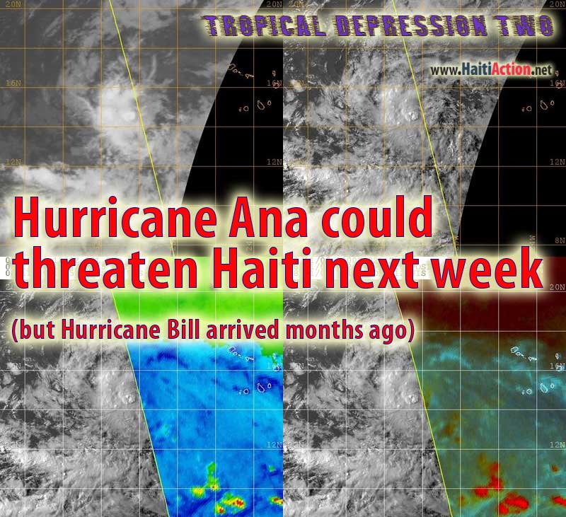
Haiti Action.net - Port au Prince, Haiti — The same day UN Envoy Bill Clinton names Dr. Paul Farmer a "Deputy," Haiti's 2009 Hurricane Season heats up with a likely, Hurricane Ana, storming through the region. Even though the National Hurricane Center in Miami is currently forecasting that Tropical Depression Two — expected to be "upgraded" to Tropical Storm Ana soon — will begin a curve to the north, it is still possible that the tropical cylone will remain near the warmer ITCZ — following the steering currents as the two preceeding tropiclal waves marching into the Caribbean — and gain strength quickly possibly reaching "Hurricane" strength if it does take this probable westerly route.
ANA will become the first named storm of the historically quiet 2009 Hurricane Season. This is only Tropical Depression Two, over two month into the beginning of the official hurricane season. The previous notable storm, Tropical Depression One was early, during the last week of May. By comparison, last year there were already six named storms. The four weeks that followed — Aug 15 - Sep 15 — were the most devastating that Haiti has ever seen. With Hurricanes Gustav, Hanna and Ike all causing massive flooding and landslides in the South and North departments of the country.
Unfortunately for UN Envoy Bill Clinton the second named storm of the 2009 season is officially sceduled to be named "Bill." Certainly, this will make for the expected comparisons in the press media — beginning with this hurricane report on HaitiAction.net — especially if the storm visits Haiti.
Tropical Depression Two has already taken on the forboding tropical cyclone formation as seen in the satellite images above, located about 400 miles west of the Cape Verde Islands off of the western coast of Africa the slow moving tropical cyclone curently has a 280º (WbN) heading at 10mph. If the storm takes a more westerly direction — 270º — it will pass very near the Mid-Atlantic weather buoy in a few days. A westerly heading will also take the storm into warmer waters which will have conditions favorable to making ANA a Category Three storm before it hits the Windward Islands. The Mid-Atlantic Buoy currently showing Air Temperature (ATMP):80.6 °F and Water Temperature (WTMP):81.3 °F
The next 24 hour period should be closely monitored by Haiti's civil defense agencies.
RAW
---- See most recent update:
Hurricane Bill will threaten Haiti this week Aug 17
---- BOOKMARK Haiti Action.net Tropical Cyclone Page for latest updates
HaitiAction.net will host a page with many Tropical Cyclone resources so you can find the latest information when you are searching for current updates. We suggest that you bookmark that page for this busy 2009 Hurricane Season.
View the latest NOAA observations near TS ANA
More information, resources and links can be found on the HaitiAction.net Tropical Cyclone Page
For the latest advisories from the National Hurricane Center: http://www.nhc.noaa.gov/index.shtml?
Map of Haiti: rezize browser window to enlarge map
Tropical Cyclone Breakpoints - Kiskeya
Hurricane reports from 2008:
Haiti waits in fear for Hurricane Ike Sep 6
Haiti’s deadly hurricane season just getting started Sep 1
Will Hurricane Hanna threaten Haiti? Aug 30
Dangerous Hurricane Gustav will hit Haiti Aug 25
Haiti's crops will be devastated by Hurricane Gustav Aug 26
Furious Tropical Storm Fay drenches Haiti Aug 1
See Also
Haiti: "The people do not buy liberty and democracy at the market" Aug 7
Clinton's 'silence' challenged in Haiti Jul 7
U.N. denials in Haiti Jun 30
Lavalas closed the doors again, elections in Haiti a disaster for Lespwa government Jun 27
